The Fred and Goose Cove study sites at Glacier Bay are only 4.2 km (2.7 miles) apart and the glacier exposed Goose Cove only about a decade earlier than Fred. The vegetation development at Goose Cove during the two decades after I established the plots (ca. 1990-2010) should be comparable to the most recent two decades of development at Fred (ca. 2000-2020). Precise comparisons require that I know how old the two sites are.
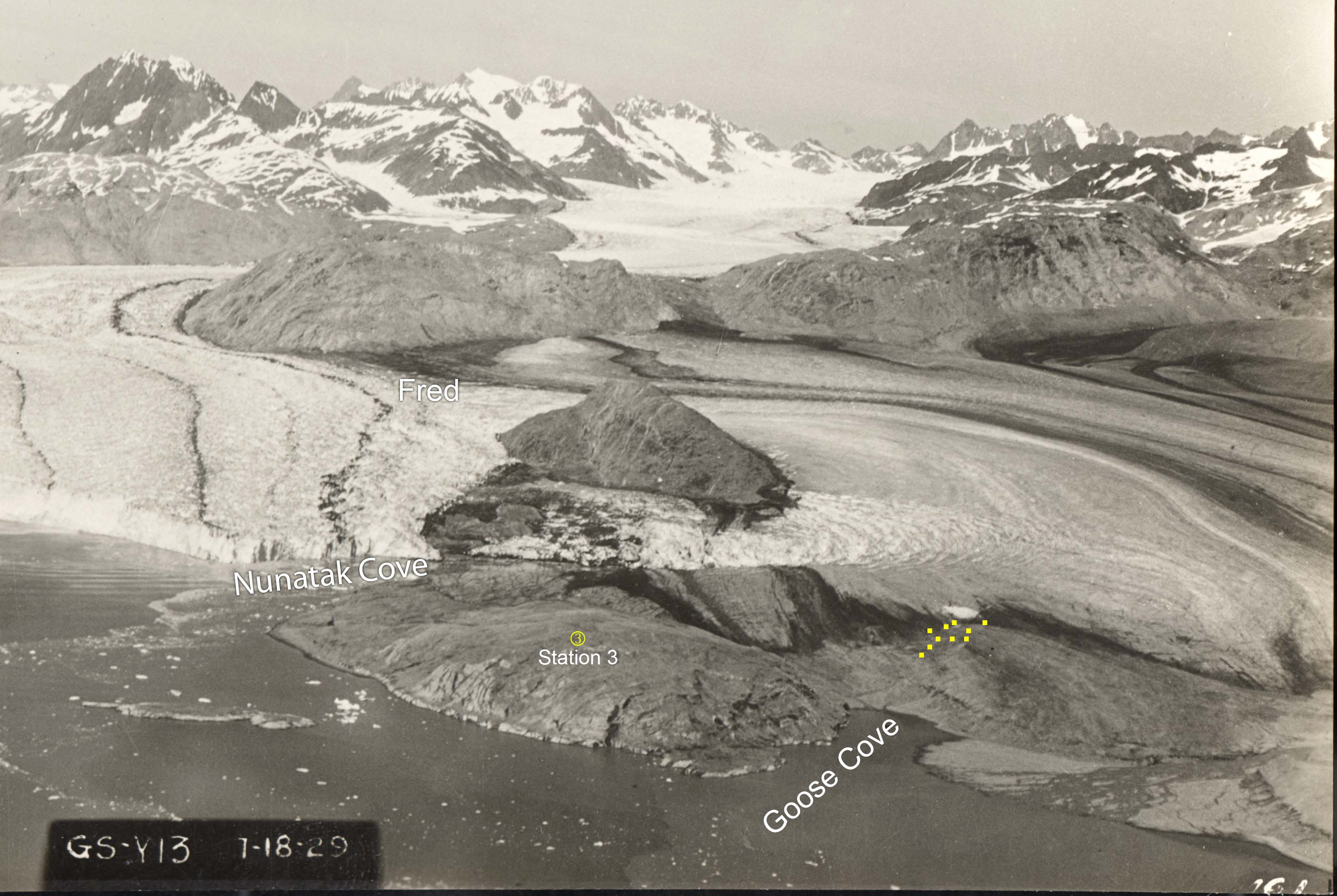
Figure 1. Oblique aerial photo of the Muir Glacier (left) and the stagnating mass of the McBride Glacier (right) in July, 1929. Goose Cove is free of ice and the study plots established in 1988 (yellow squares) are mostly free of ice. Station 3 is one of William O. Field’s photo stations. NSIDC Digital File ID: muir1929071801.Continue reading “Have photo – will date”
The second youngest of my 10 study sites at Glacier Bay is called Fred because there is a USGS benchmark there named Fred. Fred is dominated by alder. When the plots were established in 1988, there were no spruce and the average diameter of the cottonwood trees was 7 cm (2.8 inches). There were about five of these little cottonwood trees in each plot and 280 alder stems. There are 10 plots and we measured the diameter of all 2800+ stems.
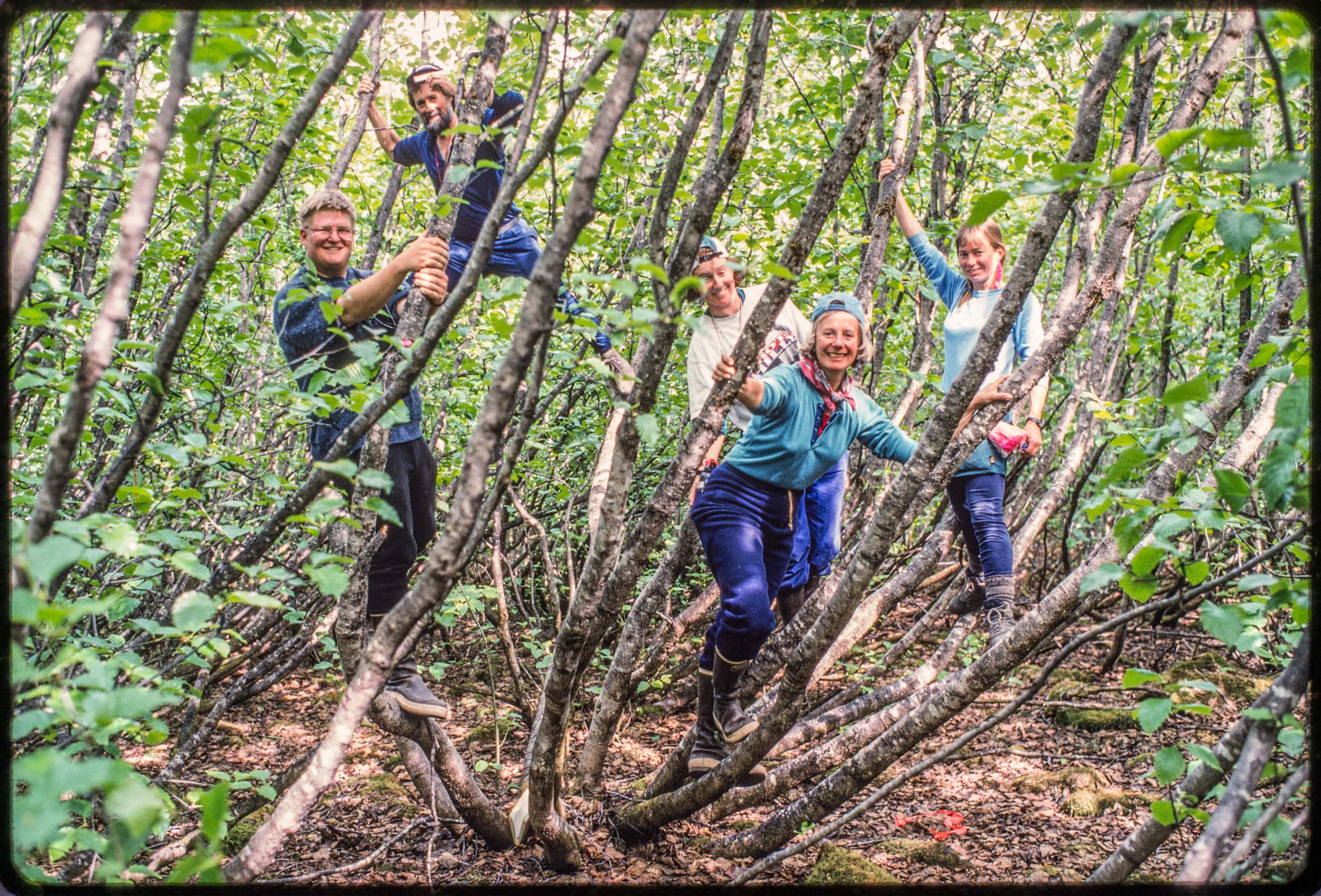
Figure 1. The 1995 field crew in Mother Alder in plot 4 at Fred. This alder was substantially larger and older than any other in the plots and probably begat many of its neighbors. Left to right: Jim Speer, Gary Bolton, Andi Lloyd, Ginger Burley, Elise Pendall. Kodachrome, May 24, 1995.
The primary source I used to date Fred’s emergence from under the glacier was an aerial photo taken in 1948. The McBride remnant, a large extent of shrinking, stagnant ice, was 550 m away from the plots and I guessed that four years earlier the ice had probably covered the plots. I was probably off by a few years.
Three decades ago I started monitoring vegetation change in Glacier Bay National Park where glaciers have been retreating and exposing new land to colonization by plants. Each of the 10 sites I study was exposed at a different date over the last 250 years and it’s important to know that date for each site. It seems even more important now that I have so much data from the sites.
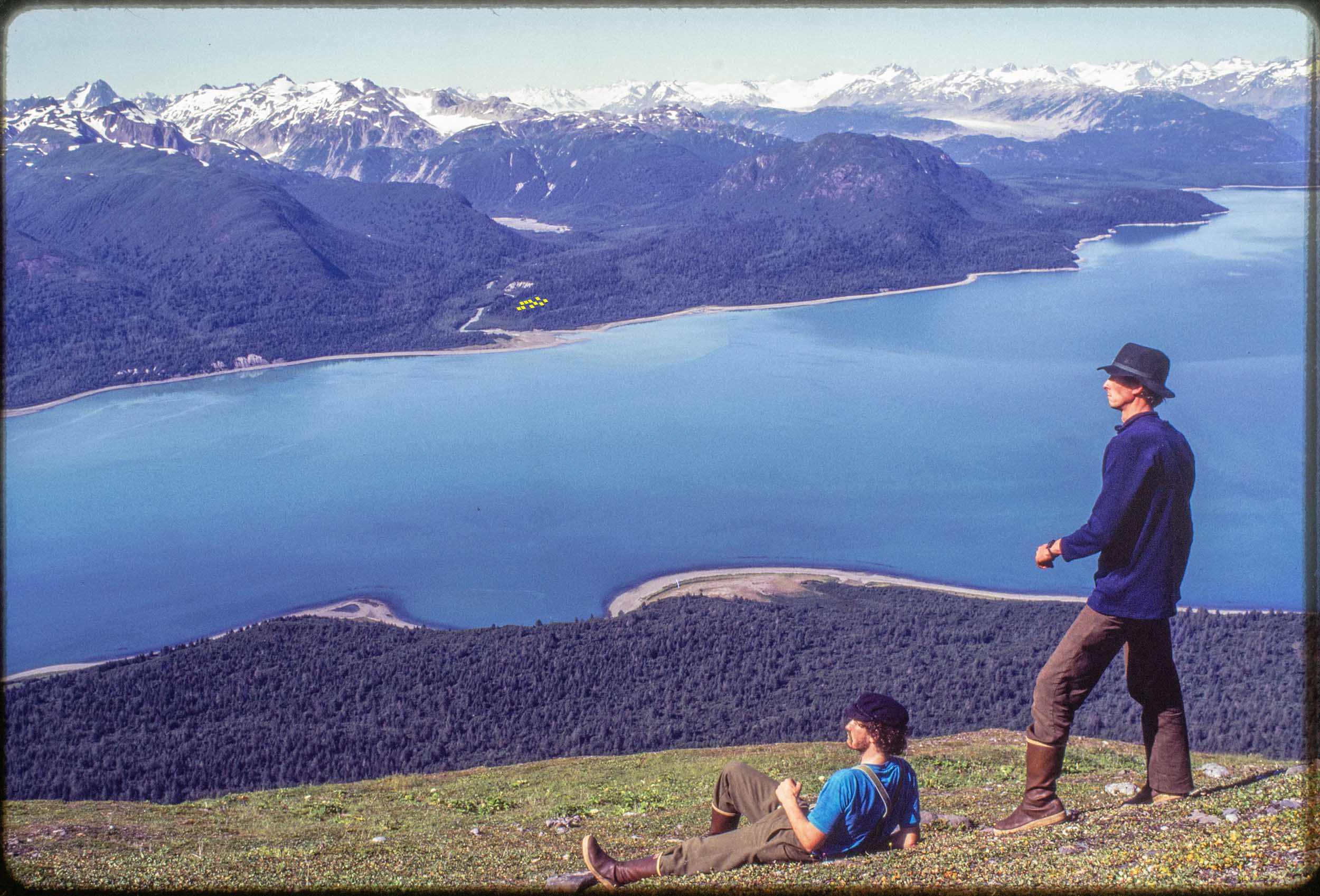
Figure 1. The view of Muir Inlet from 2000 feet above Muir Point on the shoulder of Mount Wright. Across the inlet are 10 tiny yellow squares where the Morse Creek study site is. We established those study plots near Morse Creek in 1988 without knowing exactly when the glacial ice had melted away there. Foreground: Left; H. Lentfer, Right; author. Kodachrome slide, August 1988. Continue reading “Dating retreat”