

I almost didn’t make it to the farm yesterday because 1) one of my A590s died, 2) the old CHDK sync mode does not work with A590s, and 3) it took me a while to install and learn how to use the new CHDK. Teddy almost didn’t make it because I was not sufficiently explicit about which gate I meant and he waited at the other gate. But we were flying the Sutton Flowform 16 by 5:00 PM in a janky 15 mph north wind with gusts of 20 mph. The Titan 2 Rig made its maiden flight with two A590s triggered by an MK111 timer.

One of the A590s was full spectrum (its IR block filter had been removed), and it had a 720 nm IR filter in front of the lens. So that camera saw mostly near infrared light. I white balanced that camera on grass, and the photos have a little color in them. We took 565 pairs of visible/infrared pairs over the Middlebury College Organic Farm. The cameras were aimed straight down, but the wind was swinging the Picavet quite a bit, so we got lots of slightly oblique photos, and more than 100 of the pairs were before or after the flight part of the flight. The shutter speed on both cameras was locked at 1/800 second at ISO 80, and most of the photos were taken at f 2.8. Some of the NIR photos were taken at f 2.6 (the max aperture), but there was not much difference in exposure between the two cameras. About 80% of the photos have no conspicuous motion blur.
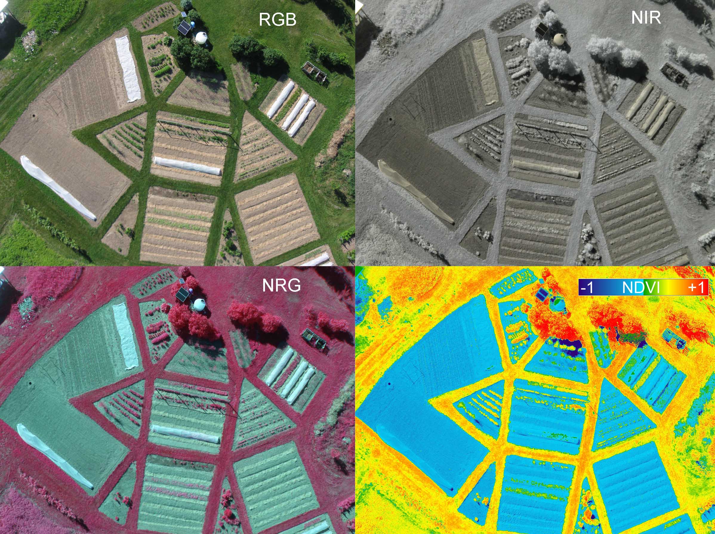
As usual, it took me an hour to remember how to use Ned’s Fiji plugin to make a text file list of the photo pairs. I had to resort to reading the manual again. But the plugin processed 428 pairs in a couple of hours (I’m not sure how long it took because I went to bed and the log file does not include time stamps). Some pairs were skipped at the beginning of the job because the plugin could not align the pair of photos, but after it matched one pair, it used the previous alignment for subsequent pairs. It seemed to do that a lot for this batch, but most of the NRG images look sharp, so the alignment is good.
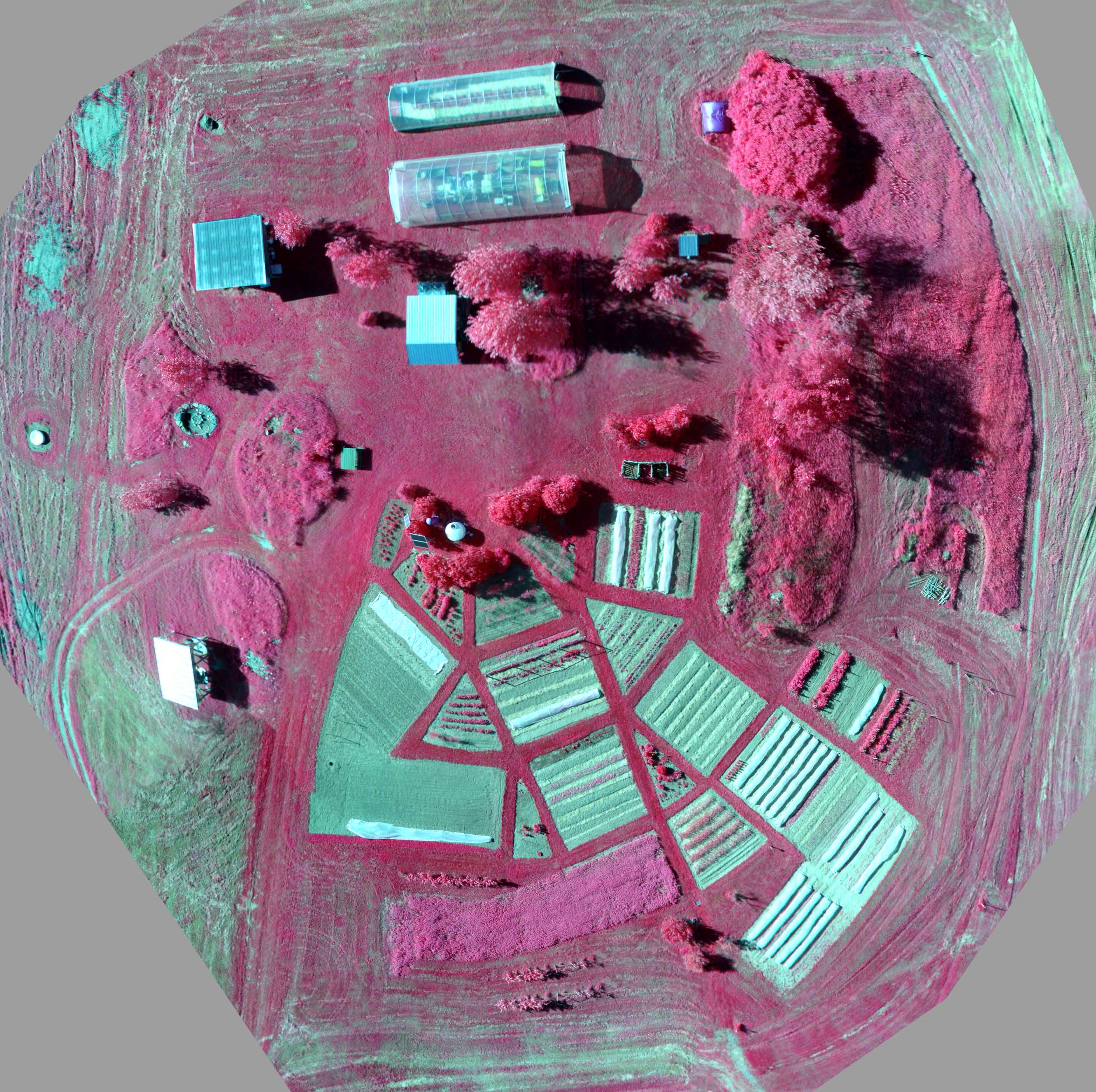
I gave Microsoft ICE 47 lower elevation NRG images, but it only stitched 25 or so successfully. I then gave it some that it had failed to include in that stitch plus some others and it stitched 11 of the 20. There is a lot of overlap among images in both mosaics. I patched those two mosaics together in Photoshop. There is no ground control, so don’t try to navigate with this image. The full version of this image is about 50 megapixels (7k x 7k pixels), and the one above is resampled to 6.2 MP (2.5k x 2.5k pixels). I will see how the stitching of the RGB and NDVI goes and maybe put the full resolution versions at gigapan and post a note at Public Lab [here it is].