Arrested alder

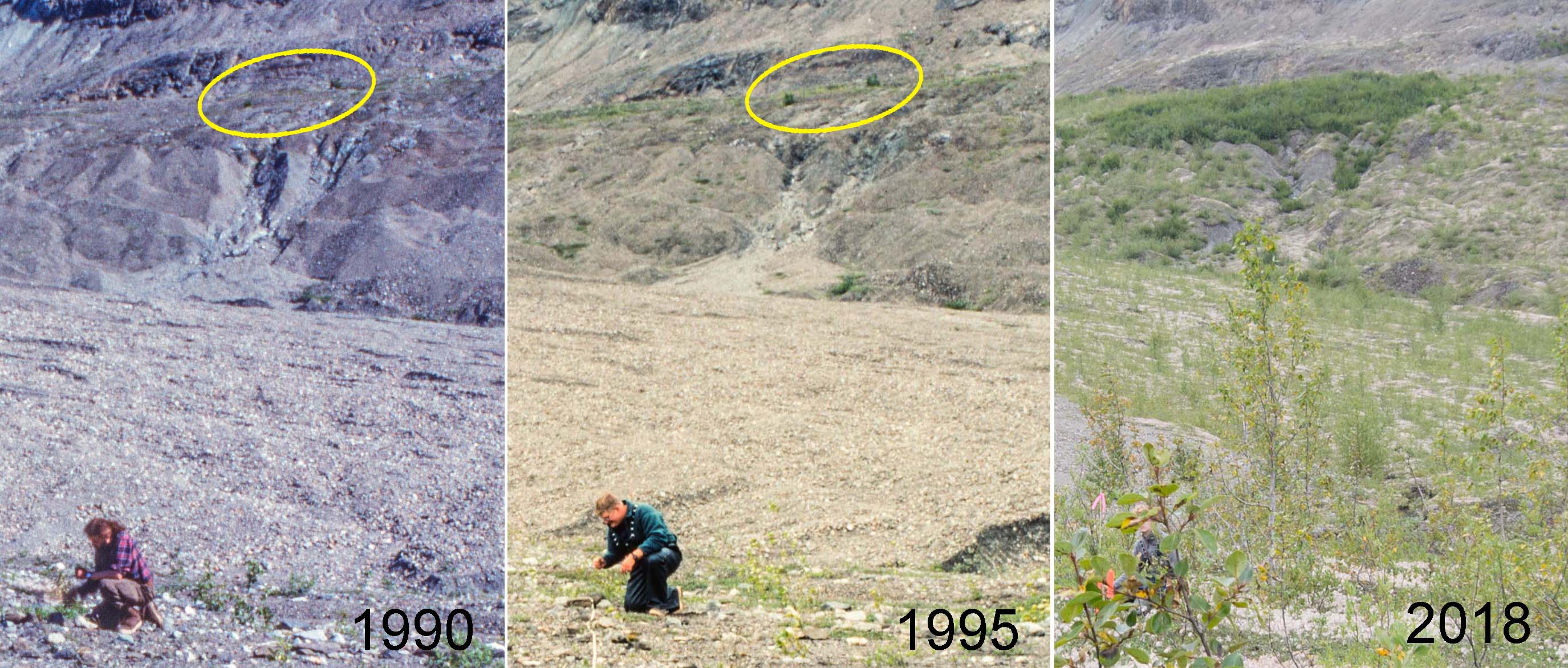
Very few Sitka alders established during the first two decades after the retreating Muir Glacier exposed my youngest study site (Site 1) at Glacier Bay. Older sites in Muir Inlet had abundant alder plants by the time the surface was 20 years old, and it seems likely that the difference was caused by a shortage of alder seeds arriving at the young site. Today there are a few alders at Site 1, and what they have done (or not done) in the last three decades suggests a more nuanced explanation.

View from Plot 1 at Site 1 in three different years. Two Sitka alder plants visible in 1990 (ellipse) produced seeds which formed an island of alder 80 m across by 2018.

Continue reading “Arrested alder”

When alder can’t keep up

The young vegetation on the north side of Upper Muir Inlet in Glacier Bay National Park is developing dramatically differently from older vegetation a few km away. Today, five decades after the retreating Muir Glacier exposed my youngest study site (Site 1) to plant invasion, it supports an open shrubland of willows with most of the ground still carpeted with low-growing Dryas drummondii. At the same age (in 1995), the next older site (Site 2) had no Dryas and was a dense thicket of 6 meter tall Sitka alder shrubs. The distinct successional pathways being followed at these sites have critical ecological differences (e.g., alder is an important nitrogen fixer) and suggest that inferring ecological change from a sequence of different aged sites in this part of Glacier Bay does not work.

Can seed rain explain this?

My favorite hypothesis to explain this is that early seed rain of alder differed between the two areas. Ice margins in Glacier Bay have been retreating to the north for almost three centuries, and invading newly exposed terrain requires that plants can migrate as fast as the ice retreats. Alder was apparently doing a good job of chasing the ice along most of Muir Inlet where my reconstructions of invasion histories at four study sites confirm that alder was an important early invader. Continue reading “When alder can’t keep up”
Vintage chronosequence

In the late 1980s, I established vegetation study plots at 10 sites along the eastern side of Glacier Bay in southeastern Alaska. These sites were more or less evenly spaced between the retreating Muir Glacier and the terminal moraine which the Glacier Bay ice had built at the end of the Little Ice Age. The youngest site had been exposed by retreating ice in 1968 and the oldest site had been exposed around 1770 soon after the ice melted back from the 1740 moraine. So on average the age difference between “consecutive” sites was about 20 years (202 years ÷ 10).

There are three approaches to learning things from this series of different aged study sites:

  1. You can assume the sites form a chronosequence so that changes inferred from the series of progressively older sites are also changes that have happened at individual sites. According to this assumption my older study sites would have passed successively through stages similar to all of the younger sites.
  2. You can be less trusting of the chronosequence and use evidence at each site to reconstruct its developmental history. This history can be compared to younger sites and to their histories to test the above assumption. Tree rings and paleoecology are potential sources of information about vegetation history at individual sites.
  3. You can wait until each site attains the age of the next older site at the time of establishment. At that time Site 1 should look just like Site 2 did when you started, and so on. If the chronosequence assumption is valid, each site will have aged predictably and you will have a new, slightly older, and now verified chronosequence. You can have some confidence that inferences about change made from that chronosequence are valid.

Continue reading “Vintage chronosequence”

Documenting Dryas

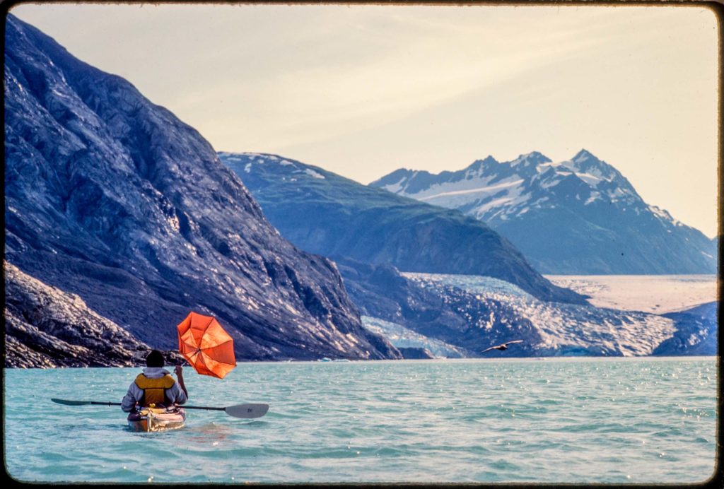
I saw Riggs Glacier on my first trip to Glacier Bay in 1984. Of the three tidewater glaciers in Muir Inlet at that time, only McBride Glacier reaches sea level today. In 1990, as one of the final field tasks for my dissertation, I established permanent study plots between Riggs Glacier and Muir Glacier. This summer Galen and I used old sketch maps to find all five of them and recorded GPS coordinates.

Lewis testing his downwind rig at Riggs Glacier. Kodachrome, July 1984

Continue reading “Documenting Dryas”

Cairn photo

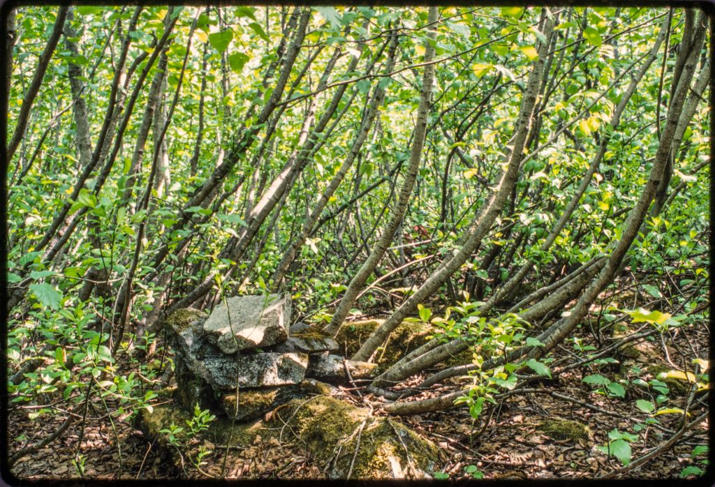
My second youngest study site at Glacier Bay is on a bench of outwash about 150 feet above Muir Inlet. Before alders covered the young surface in the mid 20th century, the bench offered a good view of the retreating face of Muir Glacier to the north. William O. Field established a photo station there maybe in the late 1940s and marked the spot with a cairn assembled of several large rocks. I found the cairn in 1988 when I set up my study plots in a dense thicket of alders.

A photo station cairn built by William O. Field near one of my study plots. This might be Field’s station “6A.” Kodachrome, May 1995

Continue reading “Cairn photo”