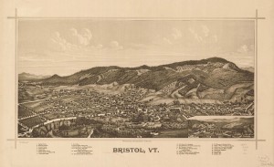
 In the late nineteenth century, hand drawn “bird’s-eye maps” were a revelation to earthly New Englanders. When exotic hot air balloons were the only way to gain such a perspective, enterprising artists just imagined what a bird might see. The customers for these maps lived and worked in the buildings depicted, so these are probably placed with some accuracy, relying on existing maps for data. It is the details of the rest of the landscape that were recorded nowhere else. In the 1889 drawing below, cleared fields, orchards, and shrubby growth nearly to the top of Hogback Mountain confirm the wisdom that in 1850 the entire slope, like others all over Vermont, was probably cleared of trees. Today, the young ages of the trees tell the same story, but an old bird’s-eye view is still a revelation.

You can view a high resolution version here: http://fastie.net/wp-content/uploads/2012/12/Bristol1889.jpg
I had been thinking about this old image, but I did not examine it before I flew a camera under a nine foot delta kite from the Mt. Abe High School in October, and the resulting panorama is from a different vantage. But now I know where the kite has to be to repeat the old view, and I think it will be possible to do it. I will need the reel with 1500 feet of line, and a more reliable wind than I had last time (disaster was averted by a lucky zephyr that stopped the fall into a poplar).
The best exploring of the panorama below is here.
.
.
A lot of trees have been processed in Bristol. Huge stacks of forest products are stored on the floodplain in both the 1889 and 2012 views.
.

.
Notes:
The Canon S95 captured 562 images during the 57 minute kite flight. Fourteen of the photos were stitched together in Microsoft ICE and two more were added in Photoshop. These 16 photos were taken within a three minute period along with 44 other photos.
.
9′ Levitation Delta kite
RC radio control of tilt, pan, and shoot
Canon Powershot S95
ISO 80
1/800 second (Tv)
-2/3 exposure compensation
28mm (eq)
manual focus on infinity
14 photos stitched in Microsoft ICE, 2 more added in Photoshop

Hi,
Just a simple question : what is the code used in your WP blog to insert Gigapan panos ?
Thnaks for your answer and have a nice day !
Manu – from France
Hi Manu,
I have used several methods to embed gigapans. The gigapan site currently produces two versions of embedding code for the gigapans in a user’s account. The simpler version is also available to anyone if the gigapan author has enabled it. I have enable embedding for this gigapan: http://gigapan.com/gigapans/131049, so you can click on “<> Embed” and get this code:
[lessthansign]iframe src=”http://gigapan.org/gigapans/131049/options/nosnapshots/iframe/2.0/flash.html” frameborder=”0″ height=”400″ scrolling=”no” width=”100%”>
Gigapan owners can also generate the following code which includes snapshots and other options:
[lessthansign]iframe src=”http://www.gigapan.com/gigapans/131049/snapshots/335487,335486,335484,335482,335480,335479/options/fullscreen/iframe/flash.html?height=650″ frameborder=”0″ height=”810″ scrolling=”no” width=”100%”>
This is the type of code I use most of the time these days.
Hi Chris, tks a loooooooot !!!!
It works fine now !!!!
http://www.lookit.org/blog/?p=2065
:) Yeah
Hi Jason, That’s quite exciting — two kite photos made a century apart, each with an alternate view displaced by a century. Your 3D viewer is a great tool for that.
I was confused at first because my kite photo of Bristol is taken from a very different vantage point than the old drawing appears to be. I was flying the kite from a place on the flat surface of the town that is just off the old 1889 image to the left. But now I see that the mountains in both images do line up. That means that George Norris drew the mountains while standing about where I was flying the kite (you can see that there were no trees there then, so the view would have been great). He then imagined what things would look like from above, but depicted the foreground as if he were suspended in the air way to the right in my kite photo (about where the rectangle is displayed for the fifth Gigapan snapshot). He didn’t make much effort to disguise that he was combining two perspectives, because back then nobody could check his work. He even fooled me. I never noticed that his mountains match the mountains in my photo. Mount Abraham, the distant peak to the right in both views, would not line up that way if you were in the air seeing the town as depicted in the old image. Very cool.
Here is similar kite panorama from San Francisco http://www.3dpan.org/3d/8568-1988-180-180 (once again, be sure to press ‘change view’ and control is from right image)
Hi Chris, I have tried my best to align these two great images for a synchronized view using my stereo viewer. Please, upon loading, be sure to press ‘Change View’ to get a side by side view. Control is from the 2012 side. The vantage was not exact, so alignment in the town was hard for someone who does not know the place, but I got most the major landmarks. Enjoy http://www.3dpan.org/3d/125435-119748-18-36