

Tag: Gigapan
Return to the Nubble
I went over to the Adirondacks last Wednesday and came back with 1900 photos. Most of them were taken by my Gigapan imager, and half of those are duplicates that will never again see the light of day. Before I even got to New York, I took 126 handheld photos from the Lake Champlain ferry, 48 of which got stitched into the three-row panorama below of the new Crown Point Bridge, still under construction. Back on August 26, the day the central “network tied arch” was lifted into position, I came to repeat the gigapan I took of the old bridge. But the place was crawling with gawkers, and the men in hard hats would not let me get to the place from which the earlier panorama had been taken. So I left defeated. If you missed it too, you can relive the raising of the arch with the fully archived construction webcams, but you have to click through a lot of photos to get to 3:30 PM on August 26 when the action started. Continue reading “Return to the Nubble”
NOrtho Photo
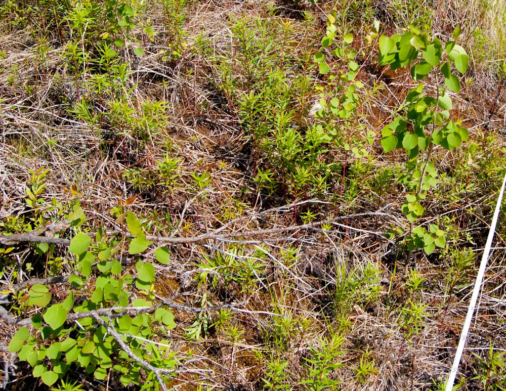
While in Alaska in June I visited some mountain treeline study plots we established in 1998 to describe and monitor the population of white spruce at the transition between subalpine forest and alpine tundra. I searched the plots for new spruce seedlings and remeasured the ones that had been previously located and marked. A wildfire burned through some of the plots in 2004, and a new tree species has since established where the organic soil was consumed. Thousands of seedlings of quaking aspen now grow in the plots, and I recorded their number and height in subplots. These are healthy seedlings growing in the tundra where, prior to 2004, the only trees were a few stunted spruce. This invasion will be either a short-lived experiment that ends when the aspens try to grow taller than the winter snowpack, or the start of a novel treeline community. Monitoring these plots will eventually reveal how this plays out, so in the meantime counting and measuring a few things is considered to be science. Continue reading “NOrtho Photo”
Built to fly
I awoke this morning to see that not a leaf on the hornbeam was fluttering, and my head fell back to the pillow in dismay. This was a sure sign that I had a new hobby. It was the KAPer’s lament: no wind. I had flown a camera on a kite for two days in a row, and the thought of a calm day was discouraging. But I had started a stitch of yesterday’s aerial panorama before I went to bed, so I got up two hours before Galen had to be at school to check on it.

I built my first KAP rig last week from one of Brooks Leffler’s kits. I have never built anything with servos and dip switches and carbon fiber legs, but I got to use my Dremel tool, so it felt safe. Brooks has designed an elegant system for suspending a camera so that it can point in any direction. The pointing and shutter release are done either at predetermined intervals (autoKAP), or by radio control from the ground. The kit I built had servo motors for both panning and tilting and electronics to automatically point in as many as 76 directions and take photos potentially covering a downward-looking half-spherical view. By replacing the tiny circuit board with a radio receiver, the motors and shutter could be controlled via a transmitter on the ground. It is based on the RC airplane/car/boat/helo standards, so compatible equipment is readily available.
.
My Flying GigaPan
It took a couple of weeks for Jeffrey Warren’s message to sink in. At first I thought his workshop on balloon aerial photography at the Fine gigapixel conference in November promoted a fringe pursuit – lofting cameras on tethered helium balloons to make better maps than were currently available. But this pursuit emerged from the elegant convergence of modern camera technology and traditional lofting methods (balloons and kites). It was now possible for anyone to make good, current “maps” from stitched, low-elevation vertical photographs. Jeffrey is committed to inventing workarounds to the technological and financial obstacles that would otherwise put this process out of reach of the communities that might benefit from good maps. This was the focus of his thesis at MIT, and he has had great success bringing communities together around these new map images and the experience of making them. He has made the objective so compelling, and the process so simple and inexpensive that I soon realized I had to try it. Continue reading “My Flying GigaPan”
It’s a flock! A crowd! No, a herd!
A few days ago the Wired Science blog at Wired.com embedded the gigapans from the juried gallery show at the Carnegie Museum of Natural History. The same content also appeared at the Wired Science Japan site, so I used some online translators to see what had been written in Kanji about my hummingbird gigapan.
Here is the text that first appeared at the Wired Science blog:
Don’t let the 40 or so hummingbirds in this panorama fool you. There are really only two. Photographer Chris Fastie called it a “perplexing distortion of reality.” He took 78 photos over the course of a few minutes, then selectively merged them to capture multiple feeding and flying positions of the birds. “Rarely will the local male allow birds other than his mate to use a food source in his territory, so a feeding flock like this is impossible,” Fastie wrote on GigaPan.org.
This caption is a bit of a “perplexing distortion” because: (1) there are only 28 hummingbirds in the image, not “40 or so,” and (2) the 78 photos taken by the Gigapan imager did not include any birds. An additional 28 photos of hummingbirds (and two of insects) were pasted onto the stitched panorama. This misinformation is partly my fault because my original caption at gigapan.org was not very explicit. So the people hired to do the translation were already at a disadvantage, like the third person in a game of “telephone.” Continue reading “It’s a flock! A crowd! No, a herd!”
Fine Conference
The Fine International Conference on Gigapixel Imaging for Science is winding down and I am really looking forward to the cocktail reception when today’s poster session ends. There is also going to be a raffle for a Gigapan Epic Pro, so there is still much to look forward to.
It has been a real joy to meet lots of people who I knew only through their work online at gigapan.org, many others whose work I hope to know soon, and all the media people who might be incorporating gigapans into their work. It was tremendous fun to see dozens of members of the gigapan community whom I met 18 months ago at my first Fine Outreach for Science Workshop. I have really enjoyed interacting with many people who are more obsessed with gigapixel imaging than I am.
The proceedings papers are now online at http://gigapixelscience.gigapan.org/. A higher resolution PDF of my paper is here. All the presentations were videotaped, so maybe they will be online at some point so I can see the concurrent talks I missed. [UPDATE: Video of my presentation at YouTube.]
The Prezis for my conference talk and the one for my Fine Outreach for Science talk are available online at Prezi.com. These are somewhat sparse in the sense that they are not very self-explanatory, but you might glean something from them if you attended my talks. Here is the motion bubble chart of my gigapan history that I used in the FOFS Workshop. And here is the kml file of Miss Pixie so you can see the Google Earth verification of the map I made of her locations. Here is a pioneering paper by Adam Dick et al. about mapping trees from 360° panoramas.
Thanks to the GigaPan teams for the tremendous effort they put into this event. It was a huge success.
Roaring Brook

Ledge
I never heard the term “ledge” used as a synonym for bedrock before I moved to Vermont. But I once heard a guy in Maryland confirm it was bedrock by saying “Yeah, I think that’s a piece of the state.”
Here is a Google Earth KML file of two ledgey places I visited this week. One was made of Monkton quartzite with some dolomite strata and a rich, unusual plant community, and I accompanied some experts who identified three state endangered species. The other was made of Cheshire quartzite with somewhat less calcium available, and I recently found a lovely grove of pitch and red pines there. A new gigapan of that Pitch Pine-Oak-Heath-Rocky Summit community is included in the KML file.
You can see photos, GPS tracks, and the gigapan by downloading the KML file into Google Earth, or by clicking the link (below the break) to open it in a new browser window, or just use the embedded window at the bottom of the post (Your computer must have the Google Earth browser plugin installed). Continue reading “Ledge”
Hot list of gigapans
I have been collecting data about the gigapans I upload to gigapan.org ever since I noticed some unexplained behavior in the View counts and Explore Scores of my first public gigapans. Unlike YouTube, Gigapan does not make archival user data publicly available, so it has to be independently collected. Kilgore661 has been doing a great public service by collecting these data for all gigapans for about three years, and you can explore his archive here and use his nifty graphing tools. I have more than a year’s worth of slightly denser data on my own gigapans. Graphs of these data are wildly revealing about the nature of Explore Scores and the inherent differences among gigapans in how they accumulate Views. I hope to show some of these results at the Fine Outreach for Science Workshop in November.

Unlike Kilgore661, I wasn’t smart enough to use the gigapan API to automate this process, so I have been screen scraping and I just had to stop. The gigapan API is essentially undocumented, but thanks to Miriam at gigapan and Will at Fastie Systems, I now have a tool that collects the pertinent data on all of my gigapans and makes it easy to paste it into Excel. You can see the tool in action here, and learn how to install it on a Web page to fetch the information about your own gigapans.
Creepy and Cute
In Pittsburgh at the Fine International Conference on Gigapixel Imaging for Science in November, there will be a gallery show in the Carnegie Museum of Natural History of huge prints of eight gigapixel images. One of these will be a gigapan of my backyard patch of bergamot surrounded by an unnatural swarm of Ruby-throated Hummingbirds. You can see the gigapan here. The detail included below is about 4% of the area of the entire gigapan which will be printed about six feet wide.

Click the image to enlarge.
Gigapans in Google Earth KML tours
I have incorporated some gigapans into Google Earth KML tours and tried three ways to share the tours with others: embedding, KML preview, and downloading. There is not a clear winner. An earlier post has examples of all three methods.
A Google Earth KML (keyhole markup language) file can contain placemarks, paths, and polygons, but it can also include a tour in which recorded navigation movements (flying around) and an audio track can be played back. If a gigapan is included in a KML file which also includes a tour, the user can see where the gigapans are on the landscape and see previews of the gigapans. When the KML tour is stopped, clicking once on the gigapan icon (or the translucent panorama) opens a popup bubble with a thumbnail and the entire description from gigapan.org. Double clicking on the gigapan icon (or translucent panorama) flies you into the panorama just as the “View in Google Earth 4.2+” link at gigapan.org does. The recorded KML tour itself cannot include flying into a gigapan; that part does not seem to play back properly. Continue reading “Gigapans in Google Earth KML tours”