Practice

Self portrait
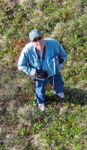
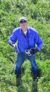
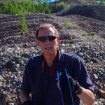
I have lost a kite, but I have never lost an RC transmitter (around neck). This was taken during one of the first short-lived launches.
The winds have been light this week as the peak colors have been waning and my KAP pack has been poised by the door. I finally had to ignore the “4 mph” reports at WeatherUnderground and WeatherSpark and just go. I went to the hay field south of the Salisbury village where the south wind might push the kite toward the village center. There were some gusty spells that lifted the KAP rig just high enough so that I had to frantically reel it in when calm returned. Attaching and detaching the Picavet in a hurry requires more practice than I have had, and I surpassed my own record for making nasty tangles that included Picavet line, kite line, and alfalfa. At one point I didn’t have time to take off the Picavet as I wildly pulled the line in hand-over-hand, laying it across the field. After untangling (not my favorite thing), I called it a day, disassembled the Fled, and headed back across the field to the pack. When I got there the wind had picked up, so I assembled the Fled, threw it into the air, and had the rig attached when I noticed that I had left the RC transmitter out in the field — out in the huge field of alfalfa and grass that is at places a foot taller than the transmitter (the thing around my neck in the photo above). Continue reading “Practice”

Over Middlebury

I flew the Levitation Delta for 20 minutes before I had the courage to attach the KAP rig.

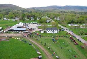
Last month I went to the Middlebury Farmers’ Market at Marble Works for the first time ever. My garden had been suffering some scurrilous blight and I was about to feed 10 people for the LEAFFEST weekend. I looked along the row of vendors to the steeple of the Congregational Church beyond some trees and realized there might be enough space to launch a kite there. A west wind would take the kite the length of the lawn and then over toward the church on the “Green,” the village commons. This could offer a unique view of the village center. But the wind almost never blows from the west here due to the north-south trend of the Champlain Valley. Other wind directions would make the flight less rewarding and the launch and landing more risky, and I had never flown a kite from such a small area surrounded by so many power lines, buildings, trees, river banks, and busy roads, so I assumed I would never fly there. Continue reading “Over Middlebury”

Design, Build, Turn

I think it is time to upgrade the technology I have used for 14 years to monitor the temperature of my compost pile.

The graph below is live, as long as I keep going out and reading the temperature and coming back in and updating the Google spreadsheet. In 1998 I inherited the old YSI thermometer device and found a 7.5 volt mercury battery for it. The battery is still good, and I even have a spare (also 14 years old). I hope that the participants at LEAFFEST can help me find a replacement technology for the beast.

The featured pile was built on September 10 from a three month accumulation of kitchen, garden, and yard waste, some old hay mulch, freshly cut alfalfa, 100 chopped corn plants, a quart of organic fertilizer (5-3-4), and 20 gallons of spent tomatoes, cucumbers, peppers and cabbage. The pile was turned on October 7.

Downlink
Special parcel (Gift) for Mr. Fastie

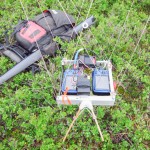
Twice this year I walked around for more than an hour flying a kite-lofted camera that I thought was taking photos, when in fact it was just fooling me into getting exercise. On the first occasion the shutter controller battery died, and the other time the camera just got confused and stopped shooting. I think I sent radio commands to shoot too frequently and it decided to take a nap. This happened another time as well but I happened to reel everything down after only 20 minutes of not taking photos while I was jogging here and there. I have modified the controller so the battery lasts much longer, and I have learned to be patient when sending radio commands, but I am certain that the rather fragile KAP rig electronics will surprise me again with their unexpected inactivity. So I have been looking for a way to monitor the camera operation from the ground. I have been brainstorming with some friends about how to do this, and Don Blair, a physics graduate student at UMass has been prototyping an alert system based on a $20 pair of walkie-talkies. I couldn’t stand hearing about all the fun he was having in Amherst using MOSFETs to remotely push the walkie-talkie PTT button, so I decided to build my own solution. Continue reading “Downlink”

Sprucing up the hills
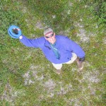
The Fled overflies as I reel it in.
It has been 14 years since we set up our first study plots south of the Alaska Range. I just returned to Fairbanks from a week-long trip to re-census the plots located above the upper forest limit at the Canyon Creek and Monahan Flats sites. There were a few scattered spruce trees and a total of a few dozen spruce seedlings marked with numbered tags in the quarter-hectare plots in 1998. The trees have not changed much, and only 8 to 10% of the seedlings have died. The surprise was the number of new spruce seedlings that have established in 14 years.
NIR/VIS KAP rig
The NIR modified and normal A495 cameras with AuRiCo controller. Synchronous, vertical photos were taken every 16 seconds.
Seedling density increased by a factor of 2.9x at Canyon Creek and 2.2x at Monahan Flats. The similarity between the two sites suggests that the seedling invasion may be widespread. These seedlings have a lot to endure before they become trees, but if similar numbers of seedlings continue to establish and many of them become trees, these plots will no longer be above treeline in 50 years.

I was able to get some aerial photos of most of the plots after I had marked each seedling with pink flagging. I flew a dual camera KAP rig with normal and infrared-modified cameras lofted by a kite. I will be experimenting with false color IR (NRG) and NDVI images which can be created with information from both cameras. Continue reading “Sprucing up the hills”

Chatanika Dredge
Radio Control
I flipped the joystick 1200 times to trigger the shutter (the 4 GB SD card filled up 10 minutes before I pulled it down).
The S95 captured 1170 photos in 1.5 hours while the Fled flew over the relic Gold Dredge #3 of the Fairbanks Exploration Company (F.E. Company). It was built in place in 1927-1928 and dug its own pond which it moved around until 1958. Hundreds of acres of the Chatanika River valley were turned into these concentric ridges of tailings as the placer gravels were devoured by the floating dredge and disgorged by the systematic arcs of its conveyor arm. Continue reading “Chatanika Dredge”

Go Orioles!

A month ago, on May 10, I noticed a wad of dry grass in the birch tree outside my home office window. It was obvious what it was, and a noisy pair of Baltimore orioles soon confirmed that a nest was being constructed. Four days later the nest building seemed to be mostly completed, and I stopped taking photos (click them to enlarge).
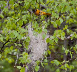
Female Baltimore oriole weaving a nest in paper birch tree
May 11, 2012. Female Baltimore oriole weaving a nest in a paper birch tree
Continue reading “Go Orioles!”

Swamp NDVI

On May 5 my infrared KAP rig made its first photographic flight. The shutters of two Powershot A495 cameras, one modified to record only near-infrared (NIR) light, were triggered every 10 seconds by an AuRiCo KAP controller. The Levitation delta kite hoisted the rig over the northern edge of the Salisbury Swamp, VT. In about 1.5 hours, 420 synchronous pairs of normal and NIR photos were captured. It has taken a while to process just a fraction of these images, but the results are promising. First, some kite porn:


Continue reading “Swamp NDVI”

Unexpected Panorama

KAP over the Kame terrace from Petri's field
Note the Henry's Handle hanging from the belt. The kite line is cleated to that while I attach the Picavet and run through the pre-launch checklist.
The huge kame terraces in my town support a dry-tolerant forest of oaks, beech, and red maple, and as the new leaves emerge it is easier to tell the species apart at a distance. So I have been hoping to fly a kite over the terraces in early May and see if the trees delineated the terraces. The wind was gusty today, but it was supposed to calm down a bit in the afternoon, so I hiked up the hill and launched the nine foot Levitation delta. It was after 6:00 PM when I first triggered the S95 with the Futaba transmitter, and the light was wonderful even if the wind was not. It mostly cooperated until it slowed down enough to send me running upwind barely fast enough to keep the line out of the trees. But I had 900 feet of line out for a while and the camera was well out of the clearing were it could see the tree tops as I never had. Continue reading “Unexpected Panorama”

Sunrise Orchards

We looked into the sun a lot that day.
At midday on Sunday. With a north wind, we looked into the sun a lot that day.
There was good sun and enough wind to loft a camera on both Saturday and Sunday last weekend, and the apples were just starting to bloom. So I knocked on Barney Hodges’ back door and introduced myself. Barney bought a 200 acre dairy farm in 1974 and started planting apple trees. His son runs Sunrise Orchards now, and Barney seems quite content to be in his beautiful old farmhouse in Cornwall surrounded by thousands of apple trees that he planted. He graciously permitted me to fly a kite and take photos, and I did. Continue reading “Sunrise Orchards”